Tuesday 9 June 2020

The Historic Border Town of Shrewsbury

The market town of Shrewsbury in Shropshire is surrounded by a loop of the River Severn and has a Welsh Bridge and an English Bridge, which gives some clue as to its proximity to the Welsh/English border. But first things first: what about the name itself? Is it pronounced with an ooo in the middle, or an oh? Even its inhabitants are divided, with some saying it's 'Shroosbury' and some saying it should be 'Shrowsbury'.


Although nothing of the original Anglo-Saxon buildings have survived, the name itself was recorded as early as 1016, as Scrobbesbyrig (possibly meaning the fortified place of a district called The Scrub). The Normans found it hard to say ‘scr’ and changed it to ‘sr’ and then ‘sar’ which got confused with ‘Sal’ so that it became ‘Salopesberie' (the abbreviation of Shropshire is still ‘Salop’ to this day). An English form persisted, though, in 'Shrobesbury'. This had changed to 'Shrouesbury' by 1346. But towards the end of the century, ‘Shrew’ spellings appeared, such as 'Shrewesbury' in 1386, which alternated with 'Shrow' spellings thereafter. The two spellings appear to have been equally acceptable, and thus the argument over pronunciation began.*

The stone head of Roger de Montgomery
However you say the name, there is no disputing that the town is stunning, with much architectural merit. The original Norman castle and abbey were built by Roger de Montgomery after the Conquest in around 1080 but the castle which stands today is a rebuild from the twelfth century. (The abbey was the setting for the Brother Cadfael novels by Ellis Peters.)

Although nothing much survives of the building pre- and immediately post-Conquest, the medieval streets are much in evidence as in, for example, Grope Lane, where the building almost kiss each other above street level.

Grope Lane
And yes, much worse probably went on at ground level, hence the name! At the top of Grope Lane is the Bear Steps Gallery, in a building which was a  - possibly - fifteenth-century hall although dendrochronology has produced frustrating results, with not all the timbers being dateable. This is also a reminder that not all these ancient buildings have, or would have, survived. In the mid-twentieth century, the buildings collectively known as the Bear Steps had become a group of barely habitable, run down cottages, which were condemned. The buildings would have been demolished had the Civic Society not raised the money necessary for the renovation and restoration.


Only the Lady Chapel remains of St Chad’s, which was the largest of the town’s medieval churches. St Alkmund was a revered Mercian saint, and the church dedicated to him in Shrewsbury was founded during the ‘reign’ of Æthelflæd, Lady of the Mercians.

St Alkmund's Spire
The tower and spire though date from 1475 and the chancel and nave were rebuilt in 1795. St Mary’s, nearby, is intact from the medieval era, with the earliest sections built from 1170 onwards with stone from the nearby Roman city of Wroxeter. St Mary’s is where I found some Anglo-Saxon grave markers. Phil, from the town’s museum, had sent me to look at what are the only Anglo-Saxon bits of Shrewsbury visible to the general public. ** St Mary’s is also famous for the fourteenth-century stained glass ‘Jesse’ window, which depicts Christ's family tree.

Anglo-Saxon Grave Markers

An interesting building is the ‘Hole in the Wall’. This building started life as a family home in the thirteenth century and has been a pub - the Gullet Inn -  and, in its time, also a slaughterhouse and a debtors’ prison. It is said that the original ‘hole’ was where the prisoners were kept, in a single cell. It is rumoured that these souls are still there, trying to get free… The family who owned the original building were the Schitte family.


The Schittes appeared first appeared in the town records in 1219. And yes, the name probably suggests that they were involved in the unpleasant but necessary business of removing night soil in the town. Still, it seems that they outgrew their lowly origins and later records show that they became high class cutlers, which, although the name suggests the manufacture of cutlery, may at this time have involved the making of swords. (The word cutler derives from French and means ‘maker of knives’.)

How the original 'Hole in the Wall' building might have looked

Medieval guilds were, of course, powerful institutions and one of the leading guilds in Shrewsbury was that of the Drapers. They were responsible for the construction of many of the timbered houses in the town which still stand today, including Rowley’s House, a sixteenth-century edifice that used to be home to the town’s museum and art gallery and which is also supposed to be haunted.

Rowley's House
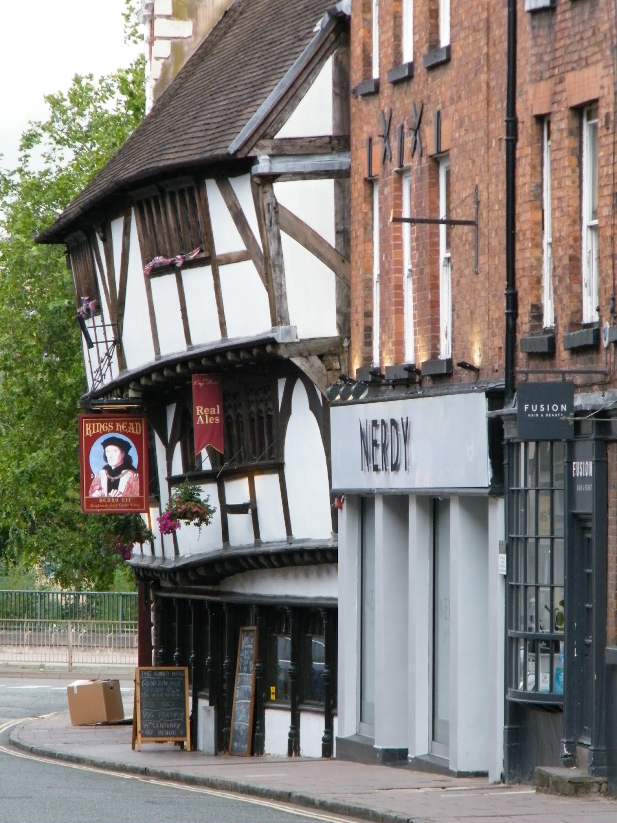
The Henry VII pub promises free hugs (alas, not free beer!) and also boasts of fourteenth-century art. Sadly, it was shut when I arrived so I couldn’t investigate whether this art was in the form of murals, or something else. Note how much the building leans though!


Shrewsbury is famous for its medieval origins and its strategic importance - the bridges in/out of the town are relatively modern but crossings have existed since at least Norman times - and of course for the bloody battle of 1403, but it has other, more modern, claims to fame.

The Methodist, John Wesley, preached in the town in 1761 and he was there to witness the opening of the first Methodist chapel in Shrewsbury. Perhaps the town’s most famous son was Charles Darwin, author of On the Origin of Species. He was born at Mount House and attended Shrewsbury School.

AE Houseman wrote about the town in A Shropshire Lad. As I've already mentioned, Ellis Peters set her Brother Cadfael books there. Another literary connection is that of Wilfred Owen, the WWI poet whose most famous work is probably Dulce et Decorum Est. I was informed that his mother received the news of his death while the local church bells were ringing to celebrate the end of the war. Such tragic timing.

If you find yourself in the area, a good starting point would be the museum and gallery, where you can learn about the history of the area from Roman times, through the Medieval Gallery and beyond to the Tudor and Stuart periods. I recommend a visit; you won’t be disappointed.


*See Margaret Gelling, Signposts to the Past, pp 28-9
** He told me that an Anglo-Saxon cellar has been excavated, but it is in a private house and not open to the public.
[all photographs by the author]

This article originally appeared on the EHFA (English Historical Fiction Authors) blog on 15 September 2019
See my follow up post there on the bloody Battle of Shrewsbury

Thursday 16 November 2017

County Wicklow - Irish History and the Welsh Connection

A few years ago we went on a family holiday to Eire, a place where I'd never been before. Our youngest child endures the most terrible sea-sickness, so we kept the ferry journey as short as possible and limited our driving time once we'd crossed over the Irish Sea.

This meant that for logistical and practical reasons, our holiday was centred around Wicklow (with a day jaunt to Dublin.)

But no matter - there was all the history I could want, right there.
We stayed in Arklow, where the castle is, sadly, just a ruin.


It seems likely that the castle was erected in the 1170s by the followers of Richard de Clare (known as Strongbow)

Our youngest (yes, her again!) was at the time fascinated by all things Tudor, particularly the series The Tudors, and so was delighted to learn that a lot of the programme had been filmed in this area. We set off to explore the filming locations, starting with Powerscourt. The house is no more than a shell, used instead to house artisan shops, but the gardens and grounds are magnificent.


Powerscourt was transformed from the original castle into a 68 room mansion in between 1730 and 1741. It was destroyed by fire in 1974.

Another site associated with the TV series is Kilruddery House. As soon as we arrived, we recognised the twin rectangular ponds and the hedged area where many of the characters walked when they did not wish to be overheard.


In 1539, Sir William Brabazon of Leicester secured ownership of the Abbey of St. Thomas; the monastic lands of St. Thomas’s included the lands of Kilrotheri (or Killruddery.) The house was remodelled and extended by future generations of the family, who became the Earls of Meath.

When we ventured further afield (of which more in a moment) we came across a building which was associated with one of the real-life characters who played a part in the series - Francis Bryan. He married into the Ormond family, and we were delighted to be able to visit Ormond Castle.


In this photo you can see the original castle behind the grand Tudor house. Ormond Castle was built by Thomas, the 10th Earl of Ormond in the 1560s. Closely integrated into the manor house are two 15th century towers. It is the country's only major unfortified dwelling from that turbulent period. 

We visited Ormond Castle on our way back to our base, having been out to Tipperary to see the Rock of Cashel. The round tower dates from around 1100.


The Rock of Cashel was the traditional seat of the kings of Munster before the Norman invasion. The cathedral was built in the 13th century.

In Wicklow we went to Glendalough, driving through terrain which has been used for films such as Braveheart and Excalibur.


This is where the hand of the Lady of the Lake 'appeared'
Glendalough is a place where you cannot help but be transported into the past. A monastic 'city', it was founded in the 6th century by Saint Kevin.

In Wales, Kevin is known as St Cwyfan, and he was a disciple of Saint Beuno. He built a Christian missionary at Aberffraw on the Ynys Môn (Anglesey)

Very near to Glendalough is the Wicklow Arms, a pub which houses a fine collection of rare and first editions of work by Irish authors, including Bram Stoker's Dracula.

We only had a week. We managed a trip to Trinity College in Dublin where I was able to see the Book of Kells.

I can't wait to go back one day and see what else Ireland has to show me.

[all photographs by and copyright of the author]

Thursday 19 October 2017

Humphrey Head - Home of the Last Wolf?

Although I live in the English Lake District, sometimes we like to drive where it's quieter, heading out along the Furness Peninsular. The featured walk today begins at Allithwaite, a village between Grange over Sands and Flookburgh.

There is a bit of debate about the meaning of the name 'Allithwaite'. The first suggestion I found was that it derives from the Old English Holy Well (Hallig Wella) and the Old Norse word for clearing - 'thwaite'- thus the clearing by the holy well. I'm not convinced by this, even though the well of St Agnes is nearby, as I see no reason why the H would have been dropped from the Halig (holy). Also the 'well' part has been dropped, leaving a name that seems to mean clearing by the holy, which makes no sense. 

Another suggestion is that it means Halle's son's clearing. Clearing is certainly the meaning of the ON (Old Norse) 'thwaite', but again I wonder about the dropping of the initial H. I rather like the suggestion that the name means 'a clearing belonging to Eilfr', although I've also seen it spelled Lilifer, which is less convincing.

The well itself, dedicated to St Agnes, was a popular destination for people in the 18th and 19th centuries, hoping to find cures for all sorts of afflictions upon drinking the water.

The first historic building to be seen on this walk is the Kirkhead Tower. It's not actually that old, probably dating from  the early 19th century, and it's the centre of a legend which suggests it was built on the site of a much earlier church, hence the name, kirk being the ON word for church.


The next historic building on our walk is Wraysholme Tower - a Pele tower built by the Harrington Family, who seem to have owned Hornby Castle but might have originally hailed from the Gleaston/Aldingham area. The ruins of Gleaston Castle can still be seen, an edifice which is thought to have been built by John de Harrington in the 14th century. (A side note about Gleaston: there is a wonderful restored WATER MILL in the middle of beautiful countryside. Parking is limited, but every time I've visited it's been incredibly quiet, so this shouldn't be an issue.)

A Sir William Harrington was a standard bearer for Henry V at Agincourt, but there seems to be uncertainty as to the exact date of the construction of Wraysholme Tower. William's father, Sir Nicholas, was knighted in 1369, but the general consensus is that the tower dates back to around 1485. Part of a working farm, it is not open to the public. 

Pele (or Peel) towers sprang up during the 15th century, defensive buildings designed to protect smaller settlements i.e. those without a castle, from border raiders. 


Heading out towards Humphrey Head, a rocky outcrop looking out over Morecambe Bay, the land is fairly flat, and the Pele Tower is visible for some distance.


We walked on, and still I could see it -


and it occurred to me that, although it was never a castle, it would still have been difficult to attack it without being seen from afar.

Walking on for some time, with the rocky outcrop to our left, I began to despair of seeing any water. I was assured that we were very near the edge of Morecambe Bay, but it was difficult to believe.


Then, just after we'd passed the field shown above...we came to the water's edge. It is possible to climb the rocks, but perhaps inadvisable, as, according to an inscription, a ten-year-old boy named William Pedder died in the attempt in 1857.


Humphrey Head is reputed to be the place where, in 1390, the last wolf in England was slain. I tried to find the source of this story, but according to Joseph Strutt (1801)
"In the forty-third year of Edward III's rule, a Thomas Engaine held lands in Pytchley in the county of Northampton, on the condition that he find special hunting dogs to kill wolves in the counties of Northampton, Rutland, Oxford, Essex and Buckingham. In the eleventh year of Henry VI's reign (1433), a Sir Robert Plumpton held a bovate of land called “Wolf hunt land” in Nottingham, by service of winding a horn and chasing or frightening the wolves in Sherwood Forest." [The Sports and Pastimes of the People of England: From the Earliest Period, Including the Rural and Domestic Recreations, May Games, Mummeries, Pageants, Processions and Pompous Spectacles]
So it seems that the Humphrey Head wolf was not the last in England. So where did the story come from? I asked Elizabeth Ashworth, author of Tales of Old Lancashire if she knew where the story came from originally. She told me: "I think that the legend of the last wolf is one that has been told again and again over time and has changed with each new telling. There are various versions of what happened but I don't think it's possible to know how true it is or where it originated." Elizabeth has a detailed re-telling on her blog which you can read HERE

In 1806, an English school text book* recorded that the wolf has "a savage aspect, a frightful howl, an unsupportable odour, fierce habits, and a malignant disposition."

In medieval times it was said that wolves spat on their paws so that their prey would not hear them approaching. Wolves have long been the subject of folklore and the 'last wolf' seems to have been killed in quite a few places up and down the country: in Cheshire in the 15th century, or Great Salkeld in Cumbria, or even at Wolverstone in Devon or Wolfscrag in Sussex. Jack of Badsaddle (Northamptonshire) was known as the wolf-slayer.

As Elizabeth says, it is probably impossible to know where the Humphrey Head story originated, but we might have a clue with Joseph Strutt's book, and the point he makes that land was held in return for hunting wolves. Lands in Derbyshire were also recorded as being held under such terms. The family, from Wormhill, had a friend who remarked in the 19th century that "There is a tradition that the last wolf in England was killed at Wormhill."

Whether or not the legend of the Wolf of Humphrey Head is true, there is a wealth of history in the area and even without it, this is a tranquil walk, with stunning views of the bay, and the open countryside.


If you are in the area, there are plenty of other places along the peninsular to visit. Flookburgh itself is a quaint market town with many old buildings, Conishead Priory at Ulverston repays a visit,
and further along, almost in Barrow-in-Furness, is Furness Abbey. But for a little bit of history, a splash of legend, and an enchanting walk in the open countryside, simply take a walk around Humphrey Head.

[all photographs by and copyright of the author]

*The Lore of the Land - Westwood & Simpson

Thursday 21 September 2017

Ruthin Revisited (Third Time Lucky!)

A couple of years ago I visited Ruthin and found so many interesting historical buildings in just one street that I simply had to blog about it

But as you'll see if you click on the link, the oldest house on the street was closed for the winter. The staff kindly let me in to the garden, but to go inside I would need to come back another day.


A few months later, on my way home from a few days break in Llanarmon  DC, I made a not too large detour via Ruthin, to look round Nantclwyd y Dre. I'd checked beforehand, to make sure of opening times, and was confident that this time I would be successful. Alas, a sign outside the door explained that - no specific reason given - the house would not be open that day.


Undeterred, on a trip back from another short break in the area, I tried again. And this time, I managed to get inside this beautiful old building.

The house dates from the 1430s, a time when the area was known for its weaving, and it's thought that the house belonged to a weaver called Goronwy ap Madog. Each of the rooms is decorated to show the different ages of the house, from medieval


to Jacobean


to the 17th century study


with its ornate plaster ceiling


to its time as a Victorian school


The main hallway shows how the house would have looked in the 1940s


Was it worth the wait to see inside this beautiful building? Yes.

But this is not the only rare preserved building in this area. A few miles away, on the road to Llangollen, I discovered a monastery. With a roof on it. It's not often that one can say such a thing, especially when Henry VIII did such a diligent demolition job on most medieval monastic houses. But at Valle Crucis there is much to see beyond the usual ruins.


 Upstairs in the monks' dormitory, there is a row of medieval grave slabs.


I was particularly interested in one of them, which seemed to belong to someone of significance. Only later did I discover that it was the gravestone of Owain Glyndwr's great grandfather, Madog ap Gruffudd. I'm so glad I had the foresight to take a close-up of it...


Although the monastery was dissolved in 1537 it is only a partial ruin and it was a delight to be able to look at the interior of the building. Note the carving on the fireplace and the upper floor wall panel.


The monastery fishpond also survives - the only remaining one in Wales - and the view across from it to the hillside is stunning.


And it's not just medieval buildings which provide stunning views in this area. Just a few miles away is the famous Pontcysllte aqueduct, built by Thomas Telford.


If you can bear it, walk along the aqueduct 


but if you can't, there is a lovely circular walk from the canal basin which takes you along a path, through some woods, to a clearing where you can see this triumph of engineering in all its glory.


Another - relatively - nearby feat of engineering would be a wondrous sight to behold, had it ever been finished. The Jubilee Tower, designed to commemorate the Golden Jubilee of George III can be seen for some distance as you climb up the hill known as Moel Famau.


It can also be seen from the other side of the valley, as you walk round the park at Loggerheads.


It's quite a landmark, even though it's a ruin, you might be thinking. But it's not a ruin; in fact it was never properly finished, as the people in charge of its construction had an argument over workmanship and, of course, money, so that the eventual structure collapsed less than fifty years later.

In this small corner of North Wales I found a building that has survived since the fifteenth-century, but only through continuous habitation and extension work, a monastery that did not fall to ruin after the dissolution, a monument that fell down because of a squabble, and the longest, highest aqueduct. Thomas Telford and the monks of Valle Crucis might have exchanged wry smiles.

[all photographs taken by and copyright of the author]

Tuesday 15 August 2017

County Durham - Home of the Prince Bishops

A few years ago I read a novel by Marilyn Durham about Ranulf Flambard, who was a minister of William Rufus and was bishop of Durham. The descriptions of the cathedral were deftly drawn and evocative, and I was delighted to find that during a recent trip away, I was near enough to Durham finally to visit the cathedral.


photo by Annie Whitehead
The building of the cathedral was begun under the supervision of William de St-Calais, bishop of Durham until his death in 1096 and who has been suggested as prime candidate for the driving force behind the Domesday survey. He was succeeded officially by Flambard in 1099. 

photo by Annie Whitehead

photo by Annie Whitehead

An image often associated with the cathedral is the famous door knocker, the Sanctuary Knocker, which those seeking refuge could sound to gain entry, and safety. The original is on display inside the cathedral; this one is a replica.


photo by Annie Whitehead

Sadly, but for good reasons, no photography is allowed inside the cathedral. Graciously, the Durham World Heritage Site allowed me to use photographs from their site. For what would a blog post about Durham be if I could not show you the exquisite Shrine of St Cuthbert and the tomb of St Bede?

Image copyright: Durham Cathedral and Jarrold Publishing
St Cuthbert is probably most associated with Lindisfarne but in fact he spent a relatively short amount of time there, at least while he was alive. He was buried at Lindisfarne, in 687, and remained there until the Viking raids on the Northumberland coast ushered in a new period of English history. In 875 the monks took the Saint's remains, and thus began his travels, via Chester-le-Street and Ripon, and finally to Durham.
My studies and research for my writing have necessitated many readings of Bede's Ecclesiastical History of the English People. I frequently write on my other blog of moments when characters from history become more 'real' to me - be it through the reading of a primary source document, or visiting a place associated with them. Standing in front of Bede's tomb had a profound effect on me, as I contemplated that here was the resting place of the man whose works, written so many centuries ago, were so familiar to me.
During this, my first visit, I looked round the Open Treasures exhibition in the monks' dormitory, where I was delighted to find Hog's Back gravestones and rare wooden coffins from the Anglo-Saxon era.  Now, a return visit has stirred my emotions: the Treasures of St Cuthbert exhibition is now open.


Passing from the monks' dormitory, still used as a working library, visitors must move through an air lock into an area with regulated temperature control. Until September, the first displays you will see are of the copies of Magna Carta, including the Charter of the Forest


Downstairs in the old kitchens, you will find the original sanctuary door knocker. For a moment, it diverts one's attention and then, you see it - St Cuthbert's coffin. I was surprised just how many fragments remain, and it is simply displayed, with a computer graphic explaining the meaning of all the carvings on the coffin.

Also on display are Cuthbert's comb, his portable altar, and his pectoral cross, shown below. This is my photograph of a postcard purchased from the Cathedral shop, since no photography is allowed. But it is enough to show the exquisite workmanship.


A short drive from Durham takes you to Bishop Auckland, site of Auckland Castle, home to the Prince Bishops of Durham since the 1600s. It is currently closed for remodelling and renovation, and will open again in 2018, with a new visitors' centre, at which time I have been invited to visit, so I will write more in another post.

photo by Annie Whitehead

Meanwhile, before you leave the area, take a short drive to Escomb, where you will find, in the most incongruous of settings, a rare example of a stone-built Anglo-Saxon church. Click on the link below to read more about this wonderful building.

photo by Annie Whitehead